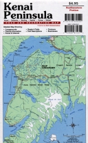
Kenai Peninsula Road & Recreation Map

- Publisher: Todd Communications (1997)
- Map - folded
- Literary Category: None
- Pages: 0
- Cover Type:
- Dimensions: 35.750" x 24.000" x 0.000"
- Weight: 2.1oz
- UPC: 721925871611
- ISBN-10: 1-57833-052-1
- ISBN-13: 978-1-57833-052-2
| SRP: | $4.95 | |||||
| Lowest Cost: | $2.97 | |||||
| Quantity: | 24 | 4 | 1 | 0 | 0 | 0 |
| Discount | 40 | 35 | 0 | 0 | 0 | 0 |
| Todd Communications Exclusive | ||||||
Fifty miles of the Kenai River, with public access points, campgrounds and popular fishing spots, are shown on this map of the northwestern portion of the Kenai Peninsula. Also shown are the Swanson River and Swan Lake canoe trail systems in Kenai National Wildlife Refuge, with descriptions of the trails and alternate routes. Five colors. Scale: 1”= 1 mile.
