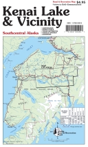
Kenai Lake & Vicinity Road & Rec Map
- Publisher: Todd Communications (1987)
- Map - folded
- Literary Category: None
- Pages: 0
- Cover Type:
- Dimensions: 36.000" x 24.000" x 0.000"
- Weight: 2.1oz
- UPC: 721925905057
- ISBN-10: 1-57833-085-8
- ISBN-13: 978-1-57833-085-0
| SRP: | $4.95 | |||||
| Lowest Cost: | $2.97 | |||||
| Quantity: | 24 | 4 | 1 | 0 | 0 | 0 |
| Discount | 40 | 35 | 0 | 0 | 0 | 0 |
| Todd Communications Exclusive | ||||||
The Kenai Lake & Vicinity map shows the continuation of the Kenai River to Kenai Lake, as well as the many maintained trails in Kenai National Wildlife Refuge and Chugach National Forest. In addition, 21 trail descriptions are given, with distances, hiking times, points of interest and level of difficulty, as well as a listing of facilities and cabins in the area. Five colors. Scale: 1”= 1 mile.

