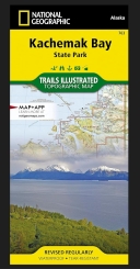
Kachemak Bay State Park #763
- Publisher: Trails Illustrated (2020)
- Map - folded
- Literary Category: None
- Pages: 0
- Cover Type:
- Dimensions: 25.500" x 37.500" x 0.000"
- Weight: 3.2oz
- UPC: 749717011779
- ISBN-10: 1-56695-074-0
- ISBN-13: 978-1-56695-074-9
| SRP: | $14.95 | |||||
| Lowest Cost: | $8.97 | |||||
| Quantity: | 24 | 4 | 1 | 0 | 0 | 0 |
| Discount | 40 | 35 | 0 | 0 | 0 | 0 |
Topographic map of Kachemak Bay State Park; waterproof/tearproof; 100% recycled plastic material produced through National Geographic Maps. Shows seven state recreation areas/sites on the Kenai Peninsula, popular beaches for clamming, hiking trails, campgrounds, wildlife preserves, docks and public use cabins. Selected GPS waypoints are located on both sides of map.

