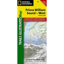
Prince William Sound West #761
- Publisher: Trails Illustrated (2021)
- Map - folded
- Literary Category: None
- Pages: 0
- Cover Type:
- Dimensions: 25.500" x 37.500" x 0.000"
- Weight: 3.2oz
- UPC: 749717011755
- ISBN-10: 1-56695-420-7
- ISBN-13: 978-1-56695-420-4
| SRP: | $14.95 | |||||
| Lowest Cost: | $8.97 | |||||
| Quantity: | 24 | 4 | 1 | 0 | 0 | 0 |
| Discount | 40 | 35 | 0 | 0 | 0 | 0 |
A topographic map published by National Geographic covering the western portion of the Prince William Sound area. It indicates the state marine parks, the lands owned by Native Corporations, and developed hiking trails. There is information concerning the public use cabins and tips on camping areas as well. The map is printed on a 100% plastic material which is waterproof and tear resistant.

